A 5 mile walk at Cwm Rhaeadr in Carmarthenshire, Wales
This is my first ever drone video after having it for 48 hours; some of the drone footage is a tad basic. Hopefully I shall polish my skills a bit over the coming months! Enjoy the walk.
Walk Description
This is a 5 mile walk that starts at Cwm Rhaeadr in Carmarthenshire, Wales - approximately a mile or so north of the village of Cil-y-Cwm. It can be extended into a longer walk by contiuing up to the standing stone on Mynydd Mallaen or by walking to the foot of the waterfall in the forest. You can see the Ordnance Survey map here
The walks is a moderate walk that starts at the car park at
Cwm Rhaeadr near Llandovery.
Park in the forest car park and walk back to the road turn right and
follow the road for several hundred meters going past some cottages in a
dip, After rising back up past the cottages you will see a wooden gate
with a track beyond. Turn up the track and follow it up, there are
wonderful views of the Brecon Beacons as you ascend.
At the end of the track is a metal gate which gives access to the open land on the mountain.
As you go through the gate turn right and (after an initial zig zag) find the track that goes up the mountain.
The track continues up until you reach a plateau on top. At this point you
need to navigate carefully in roughly a north direction. It can be
disorientating up on top; but you are aiming for a point behind the
waterfall at Craig Ddu. Also be aware of the cliff edge near the waterfall
especially in bad weather. This area can be muddy in wet weather.
Walk
down to the stream, Nant y Rhaeadr, that feeds the waterfall and cross it
carefully via the large stepping stones taking care as they are often
slippery. This is a good spot to stop for a break on the rocks that are
just behind the waterfall. The views are magnificent.
After enjoying the view continue up the path on the other side in almost a northerly direction until
you meet the footpath heading south east that brings you to the back of the forest.
Find the small gate into the forest, cross the mountain bike track and
walk down to the forest trac. Turn left here then descend down the forest
track bearing left at the first junction then swinging right at the
second. This will bring you back to the car park where you started.
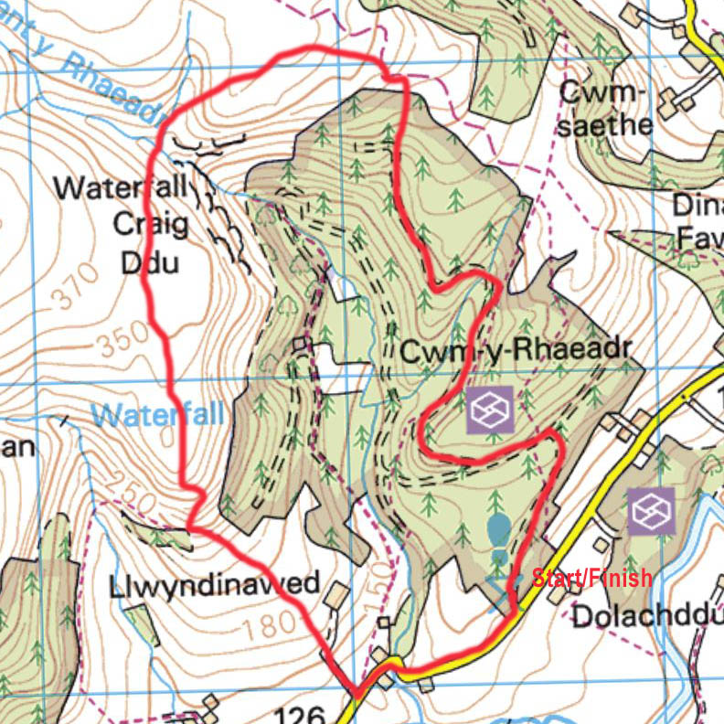
Map
The map below shows you the route of this walk. Bing Maps is a useful resource for Ordnance Survey maps and you can see the wider area here
Please ensure that you are properly equipped for the ground conditions
and weather. The information on this site is given in good faith and was
accurate at the time of writing but you are responsible for your own
safety when out walking. We accept no liability for anyone doing anything stupid!